File:Trails of Tears en.png
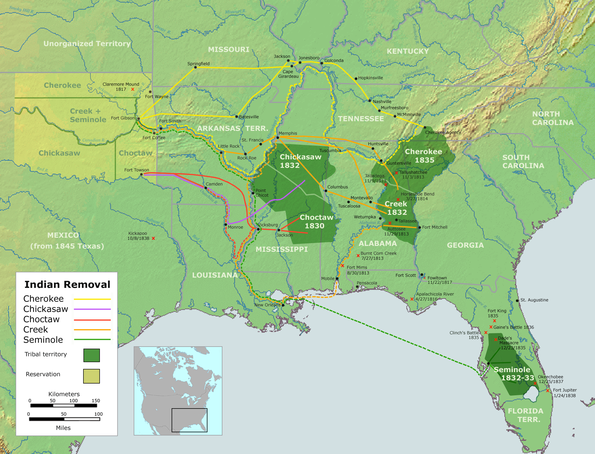
Map of the route of the Trails of Tears — depicting the route taken to relocate Native Americans from the Southeastern United States between 1836 and 1839. The forced march of Cherokee removal from the Southeastern United States for forced relocation to the Indian Territory (present day Oklahoma). User:Nikater - Own work by Nikater, submitted to the public domain. Background map courtesy of Demis, www.demis.nl and Wilcomb E. Washburn (Hrsg.) Handbook of North American Indians. Vol. 4: History of Indian-White Relations. Smithsonian Institution Press, Washington D.C. 1988. ISBN 0-16004-583-5
File history
Click on a date/time to view the file as it appeared at that time.
| Date/Time | Thumbnail | Dimensions | User | Comment | |
|---|---|---|---|---|---|
| current | 19:15, 9 April 2018 | | 2,025 × 1,547 (3.04 MB) | Admin (talk | contribs) | Map of the route of the Trails of Tears — depicting the route taken to relocate Native Americans from the Southeastern United States between 1836 and 1839. The forced march of Cherokee removal from the Southeastern United States for forced relocation... |
- You cannot overwrite this file.
File usage
The following file is a duplicate of this file (more details):
The following page links to this file: